


Tourist attractions in Ecuador
Limpiopungo Lagoon
Limpiopungo Lagoon
 BuenTrip Travel APP
Address:
Km 13.5 camino al Refugio José RivasNearby attractions
Places to visit within 30 km.

Mariscal Sucre Interpretation Center
Interpretive Center allows you to learn more about the Cotopaxi National Park. Going through the four rooms of the Interpretation Center that was remodeled approximately a year ago by the Support Program for the National System of Protected Areas (SNAP) of the Ministry of the Environment, co-financed by the Federal Republic of Germany through the KFW, is literally entering the ecosystem of the Cotopaxi National Park. The same environment to which the volcano turns, it is remarkable to know the phases of the paramo, according to the guide that guides the visitors there is the sub-paramo at 3400-3900 masl, paramo 3900-4400 masl, the super-paramo that goes from 4400-4900 masl and the icy one of 4900-5897 masl, in addition the colossus is the second highest place in Ecuador. The entire ecosystem is a source of life, not only because it provides fresh water, but also because it provides natural medicine. Also, information is shown on the emergence of springs and several lagoons such as Limpiopungo, Santo Domingo and Cajas. They feed on rain, groundwater and melting ice. These lagoons are a refuge for at least 45 species of birds, there is also data on the 10 highest peaks in Ecuador. The center is dynamic and interpretive, providing data on the 32,000 hectares of the Park, it is open from Monday to Sunday from 09:00 to 15:00 and more than 250,000 people arrive each year, of which the national tourist occupies 70 % and abroad 30%, while 80% attend the Interpretation Center. At the main entrance there is a video surveillance system that transmits both internal and external actions in real time, in order to prevent any type of damage from being done. Likewise, there are several trails such as: del Páramo, Limpiopungo, Kawsay Ñan, among others. Next door there is a "Quinde" handicraft store, Gladys Calvopiña, is in charge of selling, in the place products made in tagua and wood are sold. Everything is produced in Ecuador and by the hands of 20 artisans from the area. "We have a lot of acceptance for quality and price," she said. This has allowed to increase the datafast.
4.38 Km.

Cotopaxi Volcano
The Cotopaxi volcano offers a very beautiful panoramic view, encloses a landscape that covers the vegetation cover on its slopes, mineral features of ancient volcanic eruptions are observed, on its eastern slopes there is a refuge where it allows visitors and visitors a view that encompasses the valley and the Limpiopungo lagoon where there are wild ducks. To go up, you have to ask permission from the authorities of the Cotopaxi National Park. The Cotopaxi volcano is the tallest and most active in the world. The Cotopaxi Ecuador volcano has almost exact snow to a cone is something unique on the planet and is perhaps, like Galapagos, the greatest symbol of our natural wealth, which is known throughout the world. Because it is located in the center of the inter-Andean alley and very close to several cities such as Quito and Latacunga, it is the desire of all tourists to crown El Cotopaxi, which offers a spectacular panoramic view, its landscape allows to know the vegetation on its slopes , you can also visualize the mineral features that have left ancient volcanic eruptions, in its eastern slopes there is a refuge, where tourists can enjoy the scenery to the valley and the Limpiopungo lagoon, include wild ducks in their panorama. A permit granted by the authorities of the Cotopaxi National Park is required for them to ascend. The park is located in a volcanic area, the largest in Ecuador. In the central part is the Cotopaxi, one of the most active and highest volcanoes in the world. The Cotopaxi Ecuador is located in the central sierra region of Ecuador in the Andes Mountains What is the meaning of Cotopaxi? Cotopaxi its name means "neck of the moon", is a place name of our country. You can refer to: Cotopaxi province of Ecuador. Cotopaxi Volcano, in Ecuador. How to get to Cotopaxi Volcano? The Cotopaxi Volcano is located 60 km south of the city of Quito, reached by the Pan-American Highway. There are two well-marked entrances and roads in good condition through which you reach the Cotopaxi moors. From the Pan-American to the first refuge, it is 24 km With half an hour more walking you will reach a hostel built and maintained by the Club de Andinismo of the Colegio San Gabriel, Quito. To enter the Cotopaxi National Park you can use three routes: Pedregal-Tambo, whose access from the north is through the town of Machachi Clirsen-Bowling Area The Chasqui, crossing the center of the camelid program, is the most frequented. For lovers of mountaineering, the Cotopaxi volcano is also a family experience full of color, an extreme adventure to prove dexterity and skill. Biodiversity of the Cotopaxi Volcano A large pine plantation that covers approximately 1750 ha, chuquirahuas, pumamaquis, romerillo, mortiño and capulí, are just some of the species that can be found. In relation to fauna, curiquingues, deer, rabbits, wolves of the moor and the rarely seen Andean condor, can appear at any time. Cotopaxi Volcano Fauna The Andean condor in the Cotopaxi can find this bird that is in danger of extinction, it is an emblematic bird that belongs to the Andean moorland, other specimens such as the spectacled bear, hummingbirds, deer, wolf of moor, field mouse, rabbit wild etc Cotopaxi Volcano Flora It is classified by the type of vegetation as: Humid Forest: It is characterized by that part of the subparagraph where chuquirahua, moss, chilcas, capulí trees, among others, grow. This forest is located at the foot of the Cotopaxi volcano. Páramao pluvial: predominance of páramo straw, lichens and lycopodia. Alpine pluvial tundra: Mosses, lichens and some other species are located in smaller quantities Snow: Where it meets snow the glaciers do not allow the growth of vegetation What should you take Cotopaxi volcano? Warm Wool Cap Warm sweater A windbreaker breaks wind A scarf, warm gloves Trekking shoes Warm stockings Sunglasses, sunscreen Personal water bottle Extra money Camera Snacks Routes to access the Cotopaxi Volcano To reach the highest active volcano in the world, the Cotopaxi, Rumiñahui offers the shortest and most picturesque route called the Inca Trail, via Jatunpungo through the parish of Rumipamba. Average temperature: 3,103 and 3,174 meters above sea level Access time: The estimated travel time is 4 hours Crowning it is not for beginners. Knowing the Cotopaxi volcano is a fascinating experience, both for those who decide to feel the adrenaline and climb it, and for those who just enjoy the beautiful panoramic view that this Andean landscape offers them. Ecotourism lovers can enjoy great natural scenery, the charm of the moors, the magic of its capricious reliefs, the energy of its crystalline rivers, amid a great diversity of flora and fauna, which makes Rumiñahui a compendium of Ecuador's tourist wealth. Source: https://ec.viajandox.com/latacunga/volcan-cotopaxi-A359 https://www.goraymi.com/es-ec/latacunga/volcan-cotopaxi-a69cae589 Images: https://commons.wikimedia.org/wiki/File:Cotopaxi_02.jpg https://commons.wikimedia.org/wiki/File:Volc%C3%A1n_Cotopaxi_-_panoramio_(1).jpg https://commons.wikimedia.org/wiki/File:Nieves_del_Volc%C3%A1n_Cotopaxi_-_panoramio.jpg
7.75 Km.
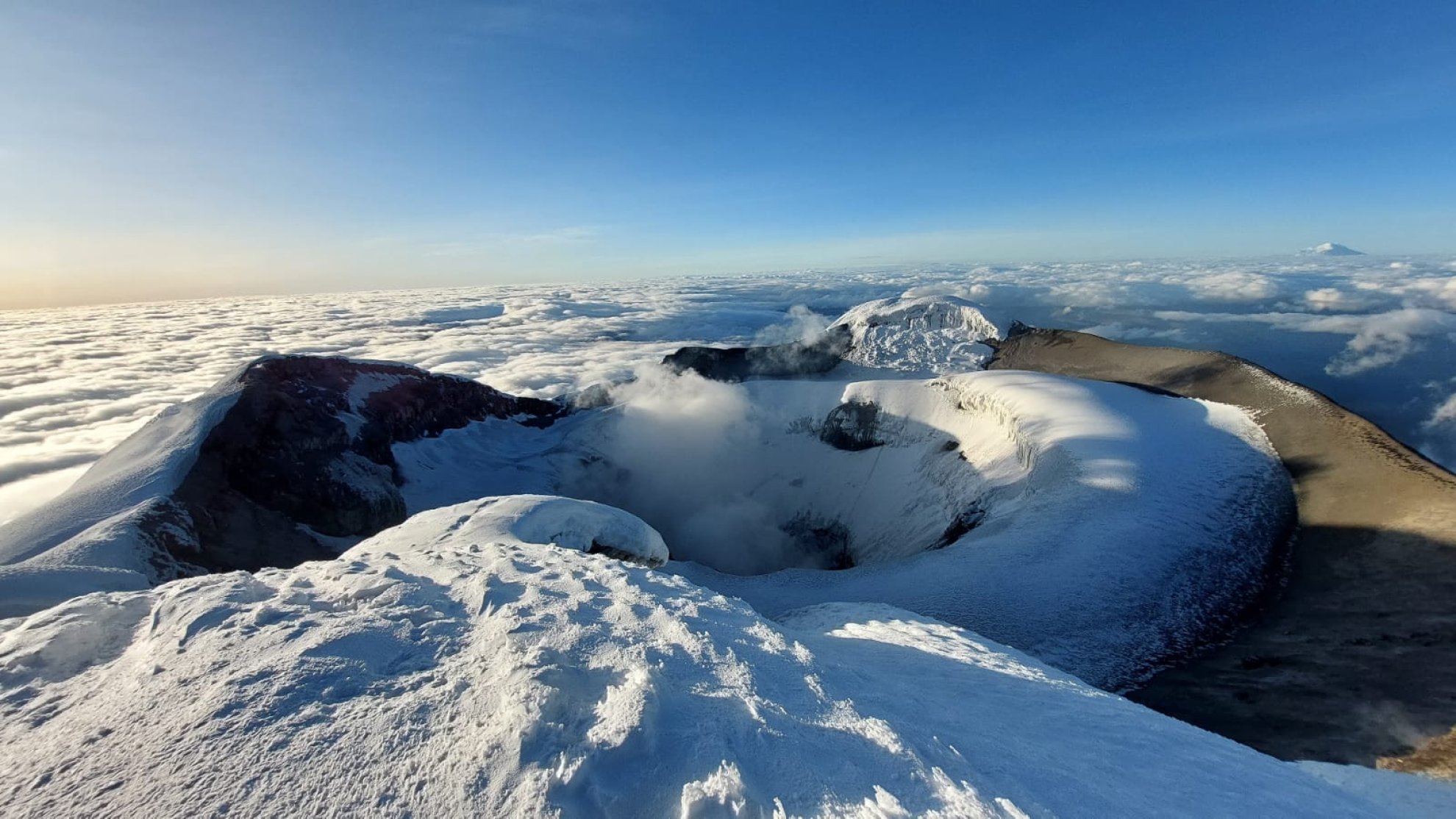
Cotopaxi National Park
The Cotopaxi volcano, with its majestic snow-capped summit and almost perfect cone shape, stands as an emblem of the Ecuadorian Andes and one of the country's main tourist attractions. This active volcano, located in the heart of Ecuador, is not only a natural jewel that attracts adventurers from all over the world, but also a cultural and historical icon deeply rooted in the identity of Ecuadorians. If you are planning a visit to Ecuador, Cotopaxi should be on your list of must-see places. But what makes it so special? Below, we'll tell you everything you need to know to make your visit unforgettable.
7.99 Km.

Morurco Hill
Cerro Morurco is a rock formation located on the south face of the Cotopaxi Volcano, it is also called the Inca's Head, due to the way its towers or rocky pillars give it; it is generally covered by glaciers; it is the remnant of the old volcanic building that was destroyed in the Pleistocene. El Morurco has a structure of pillars linked by small hills that descend in a north-south direction from the southern moraines of Cotopaxi, it has a height of 4920 m.a.s.l. and is located within the Cotopaxi National Park. During the tour you can also see the Burrohuayco ravine or canyon and the Chuquirahua Waterfall. The climate is particularly cold due to the presence of winds that come from the south, forming glaciers on the mountain. The landscape is made up of parallel packed plateaus and wide ravines, towards the east the topography sinks in the region of the valley at the base of the Quilindaña. To access from Mulaló you have to take the road that leads to the community of Ticatilín, and ascend crossing the sandbanks that are at the foot of it, the weather conditions often do not allow you to reach the top, however, in favorable conditions you can perform rock climbing from the base to almost 300 m upwards (over 4800 m.a.s.l.) for this it is necessary to use special equipment and high mountain guides.
11.00 Km.

El Boliche National Recreation Area
It is located next to the Cotopaxi National Park. El Boliche is known for its pine and cypress plantation, which covers 200 hectares and has almost completely replaced the paramo. The first trees were planted in 1928 in what was the Romerillos hacienda, with the idea of recovering the eroded soils and "reforesting" the moor. Those were other times: today it is known that these plantations affect the soil and the biodiversity of this ecosystem, and that the páramo does not need to be filled with trees. Next to this area is the "El Boliche" Station of the Ecuadorian Railway Company and, thanks to this, hundreds of visitors arrive every weekend to tour the attractions offered by this protected area. Location It is located next to the Cotopaxi National Park, in the parish of Mulalo, 27 km from Machachi and 30 km north of Latacunga. Continuing along the Pan-American highway, a sign indicates the entrance, you have to travel 3 km more along a carriageway. recommendations Wear warm clothes, rain poncho or waterproof sweater in case of rain or drizzle. Appropriate footwear, type half-round boots in case of walks.
21.45 Km.

Cunuyacu Hot Springs and Waterfall
The natural thermal water pools of Cunuyacu are located at 4125 meters above sea level at the foot of the snowy Iliniza Sur, the Thermal Waters are made up of its two slopes of underground origin, its waters are transparent and of volcanic origin, the waters rest in a kind of pool where they reach a temperature of approximately 22ºC to 25ºC, which is why they are hypothermal waters. They are one of the best preserved treasures in the province of Cotopaxi, like the waterfall of the same name; The small waterfall is shown as a waterfall of about 12 to 15 meters high, the water is at a temperature of approximately 6ºC, these natural attractions are part of the Los Ilinizas Ecological Reserve. Its name comes from two Quechua words yacu = water, cunu = rabbits, it was named in this way due to the large presence of paramo rabbits that inhabit the surroundings of the attraction.
26.51 Km.