

 Discover Ecuador
Lodging

Ecuador travel
Browse the tourism services you can book on your visit to Latacunga
Discover EcuadorDiscover EcuadorDiscover EcuadorDiscover EcuadorDiscover EcuadorDiscover EcuadorDiscover EcuadorDiscover EcuadorDiscover EcuadorDiscover EcuadorDiscover EcuadorDiscover EcuadorBrowse the tourist attractions you can visit in Latacunga

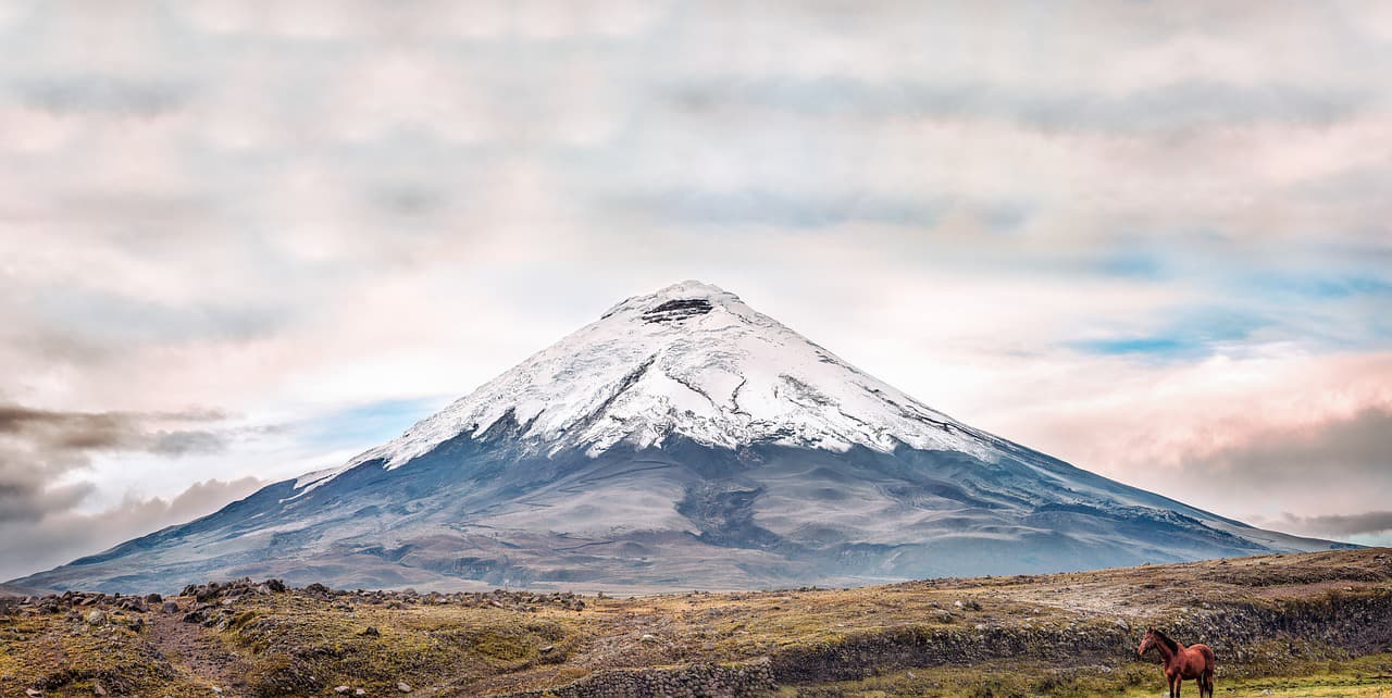
Limpiopungo or "Clean Door" is a lagoon between the Cotopaxi and Rumiñahui volcanoes. The natural landscape has a singular beauty. It is a permanent site and a must for all those who go on excursions to the Cotopaxi National Park. Another volcano that is part of the millenary scenario is the Sincholagua. Limpiopungo is located 13.5 km from the entrance to the Park, at the foot of the road that leads to the Cotopaxi Volcano Refuge. It is crossed by strong winds at surface level. The visitor can play at beating them. The mirror of the lagoon reflects the Rumiñahui volcano, a stone mass with the appearance of a mountain range. Landscape photography is the most rewarding activity that can be done in the place. When the weather is clear, spectacular shots of the Cotopaxi cone are obtained. Only one other volcano in the world is so beautiful and portrayed, Mount Fuji in Japan. The biodiversity of the moor is present in and around its calm waters. At 3,900 meters above sea level, it is a sanctuary for the rest and reproduction of the Andean gull, ducks, hummingbirds, curiquingues, condors and other bird species. Wild horses run and llamas graze on the nearby plains. It is also the habitat for deer, lizards, rabbits and spectacled bears. Those who have the opportunity to visit Limpiopungo feel that it has a special energy. It is considered a nature destination for people with different abilities and families. There is a trail that surrounds the whole lagoon. To enjoy the silence. It is possible to walk it or ride a bike. Limpiopungo. Perfect base to know the Cotopaxi National Park: the route of ascent to the Rumiñahui, mountain bike trails, camping in the Rinconada, arrive at the José Rivas Refuge and the glacier, visit the archaeological site El Salitre. The Cotopaxi National Park was created in August 1975. Its name is due to the active volcano Cotopaxi of 5.897 msnm.

Interpretive Center allows you to learn more about the Cotopaxi National Park. Going through the four rooms of the Interpretation Center that was remodeled approximately a year ago by the Support Program for the National System of Protected Areas (SNAP) of the Ministry of the Environment, co-financed by the Federal Republic of Germany through the KFW, is literally entering the ecosystem of the Cotopaxi National Park. The same environment to which the volcano turns, it is remarkable to know the phases of the paramo, according to the guide that guides the visitors there is the sub-paramo at 3400-3900 masl, paramo 3900-4400 masl, the super-paramo that goes from 4400-4900 masl and the icy one of 4900-5897 masl, in addition the colossus is the second highest place in Ecuador. The entire ecosystem is a source of life, not only because it provides fresh water, but also because it provides natural medicine. Also, information is shown on the emergence of springs and several lagoons such as Limpiopungo, Santo Domingo and Cajas. They feed on rain, groundwater and melting ice. These lagoons are a refuge for at least 45 species of birds, there is also data on the 10 highest peaks in Ecuador. The center is dynamic and interpretive, providing data on the 32,000 hectares of the Park, it is open from Monday to Sunday from 09:00 to 15:00 and more than 250,000 people arrive each year, of which the national tourist occupies 70 % and abroad 30%, while 80% attend the Interpretation Center. At the main entrance there is a video surveillance system that transmits both internal and external actions in real time, in order to prevent any type of damage from being done. Likewise, there are several trails such as: del Páramo, Limpiopungo, Kawsay Ñan, among others. Next door there is a "Quinde" handicraft store, Gladys Calvopiña, is in charge of selling, in the place products made in tagua and wood are sold. Everything is produced in Ecuador and by the hands of 20 artisans from the area. "We have a lot of acceptance for quality and price," she said. This has allowed to increase the datafast.

The Cotopaxi volcano offers a very beautiful panoramic view, encloses a landscape that covers the vegetation cover on its slopes, mineral features of ancient volcanic eruptions are observed, on its eastern slopes there is a refuge where it allows visitors and visitors a view that encompasses the valley and the Limpiopungo lagoon where there are wild ducks. To go up, you have to ask permission from the authorities of the Cotopaxi National Park. The Cotopaxi volcano is the tallest and most active in the world. The Cotopaxi Ecuador volcano has almost exact snow to a cone is something unique on the planet and is perhaps, like Galapagos, the greatest symbol of our natural wealth, which is known throughout the world. Because it is located in the center of the inter-Andean alley and very close to several cities such as Quito and Latacunga, it is the desire of all tourists to crown El Cotopaxi, which offers a spectacular panoramic view, its landscape allows to know the vegetation on its slopes , you can also visualize the mineral features that have left ancient volcanic eruptions, in its eastern slopes there is a refuge, where tourists can enjoy the scenery to the valley and the Limpiopungo lagoon, include wild ducks in their panorama. A permit granted by the authorities of the Cotopaxi National Park is required for them to ascend. The park is located in a volcanic area, the largest in Ecuador. In the central part is the Cotopaxi, one of the most active and highest volcanoes in the world. The Cotopaxi Ecuador is located in the central sierra region of Ecuador in the Andes Mountains What is the meaning of Cotopaxi? Cotopaxi its name means "neck of the moon", is a place name of our country. You can refer to: Cotopaxi province of Ecuador. Cotopaxi Volcano, in Ecuador. How to get to Cotopaxi Volcano? The Cotopaxi Volcano is located 60 km south of the city of Quito, reached by the Pan-American Highway. There are two well-marked entrances and roads in good condition through which you reach the Cotopaxi moors. From the Pan-American to the first refuge, it is 24 km With half an hour more walking you will reach a hostel built and maintained by the Club de Andinismo of the Colegio San Gabriel, Quito. To enter the Cotopaxi National Park you can use three routes: Pedregal-Tambo, whose access from the north is through the town of Machachi Clirsen-Bowling Area The Chasqui, crossing the center of the camelid program, is the most frequented. For lovers of mountaineering, the Cotopaxi volcano is also a family experience full of color, an extreme adventure to prove dexterity and skill. Biodiversity of the Cotopaxi Volcano A large pine plantation that covers approximately 1750 ha, chuquirahuas, pumamaquis, romerillo, mortiño and capulí, are just some of the species that can be found. In relation to fauna, curiquingues, deer, rabbits, wolves of the moor and the rarely seen Andean condor, can appear at any time. Cotopaxi Volcano Fauna The Andean condor in the Cotopaxi can find this bird that is in danger of extinction, it is an emblematic bird that belongs to the Andean moorland, other specimens such as the spectacled bear, hummingbirds, deer, wolf of moor, field mouse, rabbit wild etc Cotopaxi Volcano Flora It is classified by the type of vegetation as: Humid Forest: It is characterized by that part of the subparagraph where chuquirahua, moss, chilcas, capulí trees, among others, grow. This forest is located at the foot of the Cotopaxi volcano. Páramao pluvial: predominance of páramo straw, lichens and lycopodia. Alpine pluvial tundra: Mosses, lichens and some other species are located in smaller quantities Snow: Where it meets snow the glaciers do not allow the growth of vegetation What should you take Cotopaxi volcano? Warm Wool Cap Warm sweater A windbreaker breaks wind A scarf, warm gloves Trekking shoes Warm stockings Sunglasses, sunscreen Personal water bottle Extra money Camera Snacks Routes to access the Cotopaxi Volcano To reach the highest active volcano in the world, the Cotopaxi, Rumiñahui offers the shortest and most picturesque route called the Inca Trail, via Jatunpungo through the parish of Rumipamba. Average temperature: 3,103 and 3,174 meters above sea level Access time: The estimated travel time is 4 hours Crowning it is not for beginners. Knowing the Cotopaxi volcano is a fascinating experience, both for those who decide to feel the adrenaline and climb it, and for those who just enjoy the beautiful panoramic view that this Andean landscape offers them. Ecotourism lovers can enjoy great natural scenery, the charm of the moors, the magic of its capricious reliefs, the energy of its crystalline rivers, amid a great diversity of flora and fauna, which makes Rumiñahui a compendium of Ecuador's tourist wealth. Source: https://ec.viajandox.com/latacunga/volcan-cotopaxi-A359 https://www.goraymi.com/es-ec/latacunga/volcan-cotopaxi-a69cae589 Images: https://commons.wikimedia.org/wiki/File:Cotopaxi_02.jpg https://commons.wikimedia.org/wiki/File:Volc%C3%A1n_Cotopaxi_-_panoramio_(1).jpg https://commons.wikimedia.org/wiki/File:Nieves_del_Volc%C3%A1n_Cotopaxi_-_panoramio.jpg
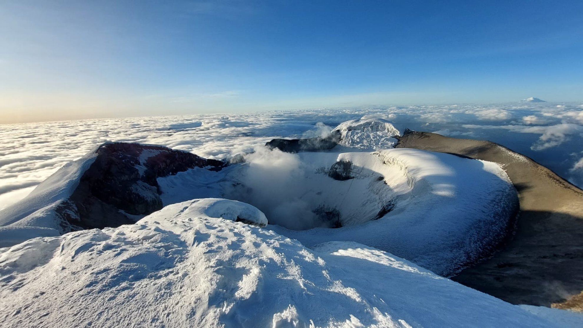
The Cotopaxi volcano, with its majestic snow-capped summit and almost perfect cone shape, stands as an emblem of the Ecuadorian Andes and one of the country's main tourist attractions. This active volcano, located in the heart of Ecuador, is not only a natural jewel that attracts adventurers from all over the world, but also a cultural and historical icon deeply rooted in the identity of Ecuadorians. If you are planning a visit to Ecuador, Cotopaxi should be on your list of must-see places. But what makes it so special? Below, we'll tell you everything you need to know to make your visit unforgettable.

Cerro Morurco is a rock formation located on the south face of the Cotopaxi Volcano, it is also called the Inca's Head, due to the way its towers or rocky pillars give it; it is generally covered by glaciers; it is the remnant of the old volcanic building that was destroyed in the Pleistocene. El Morurco has a structure of pillars linked by small hills that descend in a north-south direction from the southern moraines of Cotopaxi, it has a height of 4920 m.a.s.l. and is located within the Cotopaxi National Park. During the tour you can also see the Burrohuayco ravine or canyon and the Chuquirahua Waterfall. The climate is particularly cold due to the presence of winds that come from the south, forming glaciers on the mountain. The landscape is made up of parallel packed plateaus and wide ravines, towards the east the topography sinks in the region of the valley at the base of the Quilindaña. To access from Mulaló you have to take the road that leads to the community of Ticatilín, and ascend crossing the sandbanks that are at the foot of it, the weather conditions often do not allow you to reach the top, however, in favorable conditions you can perform rock climbing from the base to almost 300 m upwards (over 4800 m.a.s.l.) for this it is necessary to use special equipment and high mountain guides.

It is located next to the Cotopaxi National Park. El Boliche is known for its pine and cypress plantation, which covers 200 hectares and has almost completely replaced the paramo. The first trees were planted in 1928 in what was the Romerillos hacienda, with the idea of recovering the eroded soils and "reforesting" the moor. Those were other times: today it is known that these plantations affect the soil and the biodiversity of this ecosystem, and that the páramo does not need to be filled with trees. Next to this area is the "El Boliche" Station of the Ecuadorian Railway Company and, thanks to this, hundreds of visitors arrive every weekend to tour the attractions offered by this protected area. Location It is located next to the Cotopaxi National Park, in the parish of Mulalo, 27 km from Machachi and 30 km north of Latacunga. Continuing along the Pan-American highway, a sign indicates the entrance, you have to travel 3 km more along a carriageway. recommendations Wear warm clothes, rain poncho or waterproof sweater in case of rain or drizzle. Appropriate footwear, type half-round boots in case of walks.

History The Hacienda de Tilipulo played a very important role in the libertarian deed of Latacunga on November 11, 1820, since this place housed the patriots. Also from this site the freedom of: Machachi, Ambato, Riobamba and Guaranda was planned simultaneously. On August 9, 1979, the Municipality of Latacunga bought Tilipulo, at a cost of eight million seven hundred and seventy thousand sucres. Gonzalo Zúñiga was the mayor of the time. Why visit Hacienda Tilipulo? The Sundial: It was used to see the time guided by the sun depending on its location with respect to the earth, it represents the Father, Son and Holy Spirit. The water purifier: Made of pumice stone, coal and sand, it was used to filter the water, a wooden frame as a support and a vessel as a container for the liquid. The dungeon: It was built inside the Hacienda with the purpose of punishing slaves and indigenous people for their lack of authority, or the attempt to escape. El Pozo: Constructed of pumice stone and a metal door, its steps lead to a natural spring, and it also collected rainwater to supply the hacienda. It is said that the heroes made their hiding place there, which led to the altar of the Hacienda Tilipulito. The aromatic eucalyptus: It was donated by Gabriel García Moreno since his brother-in-law brought 4 useful specimens as a home remedy for respiratory diseases from a botanical explosion in Paris. The Miraflores La María sanctuary church: Completed its construction in 1772, it has 245 square meters and was used for the homily twice a day. It has a space for approximately 490 people, a speaker is not necessary since its construction in a barrel vault allows the sound to be amplified. The conversation room.- Also known as the confessional or battlement, it is a T-shaped pumice stone corridor, it was occupied so that the maidens could converse in a more intimate way, the priest received the confessions and the butler controlled the daily activities. of the entire Treasury. Schedule: Currently the administration of the farm is in charge of the Municipal Directorate of Social Development. Two guides lead the tours from Sunday to Sunday, from 08:00 to 17:00. Even on holidays.

The church of San Sebastián de Latacunga has two characteristics that make it somewhat unique compared to other churches in the city. In the first place, it is not located in the central area of the urban area, and secondly, its wide square gives it a distinctive magnitude. The area of the church also included a piece of land one block long, adjacent to the cemetery area, all of this surrounded by rammed earth. A second natural event of magnitude, the Pelileo and Ambato earthquake of 1949, once again destroyed the church of San Sebastián. Its reconstruction did not involve the old walls and the original straw roof was changed for a tile one. The temple has a single nave in a north-south direction, parallel to the long wall that faces the square, and the fountain in the center has, in turn, a pair of medium-sized towers in the front part of the transept. over the door and the balcony. Formerly in the tower there was a set of bronze bells of regular size and a small one, for the service of the cult. Inside the temple there are ancient sculptures such as a Sacred Heart of Jesus carved by Caspicara. Address The San Sebastián Church is located between Juan Abel Echeverría, Josefa Calixto Pino and Isla San Bartolomé streets. Highlights of the Church of San Sebastian The temple has a single nave in a north-south direction parallel to the long wall that looks towards the square and the fountain that is in its center, it has in turn a pair of medium-sized towers in the front part of the transept over the door. and a balcony, the one that is open on its left sector by a wooden door that shows a lintel in its upper part. Due to natural events, the sacristy shows signs of previous fractures despite which it is used and formerly in the tower there was a set of bronze bells of regular size, and a small one, for the service of worship.

The church of La Merced de Latacunga has a characteristic that gives it a certain hierarchy in the group of churches and chapels in the province of Cotopaxi. It is the site where the image of the Virgin Protector of Latacunga is found. It is built on a Latin cross plan with a single nave with two transepts, a structure that stands out for the central nave, the dome in the central part and the choir. The story goes that in order to control and order the native population, Philip IV was asked in 1648 for authorization to establish a formal convent of the Religious Order of Mercy, to evangelize 15 indigenous peoples and teach basic arts. Regarding the Virgin, she was declared "Protector of the city" for the miracles attributed to her in calming the fury of the Cotopaxi Volcano during several eruptions; For this reason, every September 24, a costumbrista demonstration is held in the popular theater called "Capitanía de la Mama Negra". It is definitely the representation of the manifestation of Catholic faith in the city of Latacunga, religiosity and important popular faith during the eruptive processes of the volcano between the 18th and 19th centuries. Location The church of La Merced is located between Juan Abel Echeverría, Manuel de Jesús Quijano and Ordóñez streets. In the city of Latacunga, Cotopaxi province. Highlights of La Merced Church On her altar we find the sculpture of a mestizo virgin, with very long human hair and is known as "The Virgin of the Volcano", she holds Jesus in her left arm and a scepter in her right arm. Inside the temple we find an altar built in gold leaf, it is armed in various styles in red with applications of noble coats of arms, both the upper and lower parts of the altar are baroque with a bit of Byzantine style. On one of the walls of the temple (right side) there is an image that represents the protection of the Virgin to the province during the eruptions of the Cotopaxi volcano, it is approximately 2.5 meters long by 2.5 meters wide and 2 meters high.

The house of the Marqueses de Miraflores is more than 250 years old, it is a complex built by Mr. Juan García de Granda in 1710 and complemented by the Flores de Vergara, Marqueses de Miraflores, in later years. Among the owners we mention the Marquis of Maenza, who lived in it until his death. The current "Casa Cuna", which is a sector of the original residence of the Marquises of Miraflores, is located in the City of Latacunga, occupying the northwest corner lot of the block. You can visit the Museum of Numismatics and Philately, the Museum of Religious Art, the textile factory and the library, in addition the department of culture of the municipality works there. Its entire construction is made of pumice stone. In the first patio you reach a room covered with an Arab terrace system and supported towards the east by seven pillars supported by stone bases from where you can see the main patio. The second patio is rectangular in shape and smaller than the first, it is surrounded by 11 strong pumice stone columns.

The building dates back to the 17th century, modified in its original form due to different earthquakes that occurred in the city, it has a facade of Doric columns with shafts, the temple is built on a Latin cross plan, with its Romanesque style, which highlights its structure. through the central nave. The upper body of the nave has columns with Ionic capitals. The plinth is made of continuous stone, they have a good harmony between the proportions of height and space, the temple as a whole is a delirium of art, on the outside there are two bell towers with dome tops. Inside the building, the convent block is projected with two-story nail plates arranged in a square with a font and gardens in the center. The temple represents the stage of the conquest and evangelization of the religious orders of the central highlands and the stage of independence. Currently it forms a neoclassical style complex, with a convent, corridors, columns and Romanesque arches. Inside you can see paintings, murals and frescoes with Mudejar art. Location The church of Santo Domingo is located on Av. Juan Abel Echeverría. In the city of Latacunga, province of Cotopaxi. Highlights of Church of Santo Domingo A chapel dedicated to Our Lady of the Rosary, patron saint of earthquakes, erected in 1690 by General Luís Sotomayor y Pimentel, remains as the main church. The interior mural paintings were worked by Brother Enrique Mideros. This church plays an important role in the history of the city of Latacunga, since it was within it that the Latacungueños patriots gathered to declare the independence of their city from the Spanish yoke.

In Latacunga, the festival known as "Mama Negra" is celebrated. The first date is The date of the black mother is from September 23 to 28 in commemoration of the Virgen de las Mercedes and is organized by the merchants of Pichincha, La Merced and El Salto, an absolutely mestizo cultural phenomenon. The second date is in the month of November for the independence of the city of Latacunga. What is La Mama Negra de Latacunga? The main character of the party is La Mama Negra, always personified by a man with a completely mute face, dressed in rich and colorful formal garments, leading the streets of the city on a horse. The black mama represents a freed slave who takes all three guys with her: two at the end of her horse and a baby in her arms. recommendations It is preferable not to accept drinks or food from unknown people as a precaution. Do not carry valuables and preferably be accompanied. If you go with small children, older adults or people with disabilities, give them an identification with the name, contact telephone number, blood type and if they have any disease, in case they get lost. During the parade, come with a hat, sunscreen and carry hydration. The troupes and the main characters generally start their tour at 09:30 am through the main streets of Latacunga. If possible, watch the parade from the Calderón central park, since in this part the streets are a little wider and the comparsas have more space to dance and show off.

The Church of the Salto has its origin in the volcanic crater of the Latacunga Seat, which, transforming into violent floods of mud and materials from Cotopaxi, systematically devastated the city between the 17th and 19th centuries. Tradition points to a miraculous action, as the starting point of a dedication to the Virgin, and consequently to the installation of a suitable site for that purpose. Thus, following the logic of popular religiosity, a modest chapel called "Nuestra Señora del Salto" was built at that point, which little by little became an obligatory pilgrimage site. The 1797 earthquake seriously damaged the chapel and it was rebuilt with smaller dimensions on the same site as the original, and which at the end of the 19th century and the beginning of the 20th, became a church with a single nave and twin towers in one direction. North South. Its structure is solid, with a central dome. Illuminated by the dome, the so-called Virgen del Salto appears. On its flanks there are two small naves parallel to the central one. The entrance to the temple is formed by an arch and pumice stone capitals. When checking the stone, someone noticed that on the side facing the stream there was an image of the Virgin. This was painted by Fray Pedro Bedón in 1618 in a hermitage in charge of the Dominicans in the "Llano de San Blas" and dedicated to venerate the Virgen del Rosario. The person who found this image in the stone spread the fact to the four winds, the population removed the stone and placed it next to the Yanayacu river itself; later, the devotees raised a chapel baptizing the image as the "Pilgrim of the Jump, the Precious Pearl of Latacunga". Location: El Salto Church is located between Juan Abel Echeverría and Antonio Clavijo streets, next to the square of the same name. In the city of Latacunga, province of Cotopaxi. The highlights of Church of El Salto The Virgin of El Salto is painted in stone, the painting could be the work of Pedro Bedón, a member of the Quito school. Church Architecture: The Church of the Virgen del Santo is a traditional church with two front towers topped with domes. Its structure is solid, with a central dome. Illuminated by the dome, the so-called Virgen del Salto appears. On its flanks there are two small naves parallel to the central one. The entrance to the temple is formed by an arch and pumice stone capitals.

The Romanesque-style San Francisco temple was built at the beginning of the 17th century, dedicating a special site to the cult of the Immaculate Conception, whose dedication is celebrated on December 8 of each year. The Franciscan order managed to get residents of the town, such as Don Francisco de Vélez or Don Diego Ruiz de Rojas, to make donations for the construction of other chapels, even for the personal use of their prosperous faithful. History tells us that its construction was completed around 1620. Of its primitive construction, only its oval dome remained, restored 30 years ago in the 1960s. Its new nave and main facade worked in carved pumice stone were built. The material is of volcanic origin typical of the region, with an attractive bell tower with lintels that rest on staggered pillars from its base to a third of its structure, where a large ancient bronze bell is visible. The structure of the church is reconstructed in a medium-sized stone frontispiece with a small double-leaf wooden door, supported by two solid rock columns, built with transverse blocks; an open and rectilinear apse in the upper part supports a small tower with a circular apse with a series of small windows and a pointed tip. Location The Church of San Francisco is located between General Manuel Maldonado and Manual de Jesús Quijano y Ordóñez streets. In the city of Latacunga, province of Cotopaxi.

Its impressive design and complementary details added to the construction material make it unique and called a monument to pumice stone, a material typical of this volcanic area, which in its time was used as the very first construction material in representative buildings. Its construction begins in the first months of the year 1910, building the main part until May 24, 1918, the year in which it was inaugurated; at that time it was not possible to finish the work, but the municipal offices were accommodated. The building of the Illustrious Municipality of Latacunga, is located on the east side of the Vicente León Park and is considered one of the most important architectural pieces in the province, it constitutes a fundamental element of the Historic Center of the city, in addition to being the house of the people since time immemorial. The earthquake of August 5, 1949, damaged some structures of the building which led to its readjustment, the original project included a horseshoe theater that was discarded. It has 2 m wide by 4.5 m high arches, with 3 m wide corridors covered in stone on the north, south and west sides. On the outside you can clearly see the pumice stone, the base of the The walls are covered with cement at an approximate height of 0.80 m, painted white and yellow.

The Vicente León National Park was the city's main square, where the liberating campaigns took place. Its layout is classic Castilian urban planning that can be seen through the straight streets of the historic center. Its immortal cloisters are visited by national and foreign tourists. Renowned is its Zoological Museum. The ashes of the Patron of the establishment are kept in its Templete. It was inaugurated on May 24, 1977. There you can see the bust of the philanthropist, in which his greatness shines, consecrated to eternally harmonizing science and culture." The Vicente León park bears the name of the Illustrious benefactor Latacungueño, a man of extraordinary patriotism, it has an octagonal shape that in its beginnings must have been the central square of the city's urban design, a place where the religious and political military activities of the nascent city were developed. , is currently a park remodeled in its original design as it consists of different works where it can be seen that the plinth is made of white quarry andesite stone, which gives it a sober elegance, together with the wrought iron fence that surrounds the park. Address The Vicente León Park is located on Sánchez de Orellana and Padre Salcedo streets. Highlights of Vicente León Park Monument to Dr. Vicente León: In the center of the park there is a large monument in honor of the illustrious character who bears his name. Built in Italy, precisely by a former student of the Vincentian campus, Carlos Mayer Stacey, a monument opened on August 10, 1925. The Cathedral: In 1975 it was intervened to carry out restoration and ornamentation works. The Cathedral is a symbol for Latacungueños as it represents the faith of a people with history and tradition

The construction is of Romanesque style, inside there is an altar worked in pumice stone, it has artistic works and colonial images; in the tower you can see a corrillon, a set of bell towers that announce the hours and the performed ucharists. It is one of the emblematic buildings of the city and represents the evident symbol of faith of the Latacungueños. The Cathedral was the center of the Augustinian campaign for indoctrination and evangelization that covered native sites such as: Sigchos and Isinliví, Angamarca, Pangua, Poaló, Cusubamba, Salachí, San Agustín del Callo and Barracas. The construction of the Cathedral rests on a plan of three naves in a north-south direction, a site respected until today, the Cathedral was built towards the west from 1950. In the earthquake of 1797 it was completely destroyed and a new construction arises to from 1850; this new building configured a new base with two transepts and a chapel and at its completion two twin towers and a dome were built, a copy of Saint Peter's in Rome. In the style of Father Nicolás Herrera. Location: The Cathedral Church is located between General Maldonado and Quito streets, Latacunga city, Cotopaxi province.

The style is sober and somewhat resembles the conventual architectural style of the late 18th century. The complex stands on a block in the downtown area of the city, one block from Vicente León Park. It was created by President Juan José Flores on May 7, 1840 and was inaugurated on May 24, 1977, being Rec-tor the Lcdo. Oswaldo Rivera Villavicencio. The cloisters in this line provide a harmonious and restful environment for visitors. The second level rises inside from a set of Doric columns. You can see the white color pregnant with serenity, nobility and powerful faith to cultivate science and virtue, and the stone that raises effort and drive. In one of the inner courtyards you can admire the bust of the philanthropist Dr. Vicente León, who, with his selfless support, managed to shape this educational institution. Illustrious men were educated in its cloisters, many of whom directed the destinies of the country: Ignacio de Veintimilla, Antonio Flores Jijón, Alberto Enríquez Gallo, Camilo Ponce Enríquez, General Guillermo Rodríguez Lara, Luís Felipe Borja, Juan Montalvo, Belisario Quevedo, Marco Tulio Varea, Luís Fernando Ruiz, Manuel Pallares, Juan Sáenz de Viten, Luciano Moral, Juan Abel Echeverría, Rafael Quevedo, Rafael Cajiao, among other characters. The ashes of the patron of the establishment are kept in its temple. Inside there are paintings and portraits from the 15th, 18th and 19th centuries, of Father Manuel Salcedo, Eloy Alfaro, Rafael Quevedo, Antonio José de Sucre, Simón Bolívar, Vicente León, Manuela Cañizares, José Mejía Lequerica.

The Museum of the Isidro Ayora School is the result of the philanthropic work of outstanding Latacungueños, among whom the Master Rodrigo Campaña Escobar stands out. It houses one of the most important archaeological collections of the Panzaleo aboriginal culture - made up of nearly 2000 pieces - which include: domestic utensils, body adornments and more; Important samples of Andean folklore, botanical and faunal species of the country and an important numismatic sample are added to this collection. Schedule: From Monday to Friday from 8:00 a.m. to 4:00 p.m. Address: San Francisco neighborhood. Quijano and Ordoñez Streets (corner) and Tarqui, city of Latacunga contacts Telephone(s): (03) 280 1401 Director and/or Responsible Nelson Espín Cell.: 099 587 7217 E-mail: isidroayora.35@gmail.com

This building has been devastated by the harshness of several telluric events that hit the area. On the same site, today stands a magnificent building consisting of a single nave with a transept and two adjoining chapels, it has a dome with artistic characteristics, similar to the dome of St. Peter's in Rome, and next to it stands the convent space . Inside you can see a collection of works of art related to the religious life of the Augustinian Order. Location The Church of San Agustín is located between the streets Hnas. Paez and Quito. Highlights of Iglesia de San Agustín Inside the temple we find the main altar with the replica of the Virgen del Quinche (on the left side) and Saint Augustine, Patron Saint of the Sanctuary, on the right side. The altar is built of wood and gold leaf. The west transept contains the sculpture of the Lord of the Forsaken, in a structure of 6 pillars, Doric, with a vaulted upper stained glass window. The transept contains the sculpture of Jesus "The Lord of Good Hope", with a structure of 6 pillars of Doric art with circumferential vaulting and a stained glass window of various colors.

The Ignacio Flores Nautical Park is also known as Alameda Park due to the abundance of Alamos that embellished the sector. It consists of a lagoon formed by a natural "Ojo de Agua", the traditional "Timbug Pugyu", it is par excellence the meeting, relaxation and recreation place for Latacungueños and visitors. The lagoon has an oval shape, approximately one hectare in length, a complex has been built in the center, to access this "islet" you cross an ornamental bridge of modern design made of concrete, at the moment it has been remodeled adding facilities such as a wooden platform for shows, children's games, outdoor exercise machines, library, children's play area, green spaces, signage, cycle paths around the 4 m wide cobbled park. Night lighting of the lagoon, ecological garbage dumps, sites of rest such as benches, tables, and a pedestrian path for those who enjoy walking; there are also cypress trees (Cupresus sp), white brush (Callistemon citrinus) and palms It has a service Boats, stage for shows, children's games and large green spaces. Location: The Laguna Ignacio Flores Nautical Park is located in the Miraflores sector in the cantonal capital of Latacunga.

Cerro Putzalahua, is conical in shape, constitutes a true viewpoint towards the city of Latacunga. Guardian of various hamlets, neighborhoods and parishes of Latacunga. Considered one of the most important in Cotopaxi. It contrasts with the extensive crops that exist in the surroundings of the hill and finally the typical vegetation cover of the moor. From the top of the peak, it is possible to see volcanoes such as: Cotopaxi, Tungurahua, Altar, Illinizas, Chimborazo and Carihuairazo. In addition, you can see the city of Latacunga, Salcedo, part of Pujilí and the Belisario Quevedo parish. Considered as a site for walks, recreational practices, interpretive talks, cycling and extreme sports such as motocross, bicycle cross and paragliding. Its name means in native language "hill of water". Location Cerro Putzalahua is located 15 kilometers from the city of Latacunga, in the Belisario Quevedo parish.

HISTORY OF LA LAGUNA DE QUILOTOA It has the appearance of a Caribbean island, but embedded in the middle of the Andes. The Quilotoa surprises more than one. From the viewpoint, located at 4,000 meters above sea level, you can see the lagoon formed in the crater of a volcano. The water, for minerals, has different shades: green, turquoise, blue. Natives, handicrafts, flora, fauna, constructions, climate, gastronomy and geography make this Andean tourist attraction one of the most sought after by national and international tourism. The journey to Quilotoa is also part of the tourist attraction, as it zigzags through the Andes and enters the Andean páramo. In the mornings, the greens of the mountains change their shade by the sun and, in the afternoon, the mist paints the duly signposted road with white. To get there, take the Latacunga-La Maná road, built by the current government. Upon reaching the town of Zumbahua, the ascent road continues for 15 more kilometers. The income costs $ 1 for Ecuadorians and $ 2 for foreigners. The vehicle arrives at a parking lot and, in its surroundings, there are crafts made by the inhabitants of Quilotoa. In addition, small restaurants, or food stalls, offer typical products of the area such as corn and beans. The food will give energy for the descent towards the lagoon. For about 30 minutes, along a dusty road, but marked with stones and sticks, you reach the edge of the Quilotoa lagoon. The cold is intense and the inhabitants of the area offer a variety of products: coffee, tea, water, soft drinks, fried foods. In addition, the transportation service is provided on horse or mule for the ascent. At a rapid pace it would rise in 1 hour and on horse it is done in 45 minutes. Tourists can also sleep in the area, in rustic cabins. The temperature at night can go down to 6 degrees in summer. They cost $ 10 per night. So in the morning you can take the time to take a boat tour of the 3 kilometers that the lagoon has. The main attraction is in certain areas where the fumaroles of the volcano are still active and heat the water. The Quilotoa lagoon is considered one of the most beautiful lagoons of volcanic origin on the planet. The most significant feature of this lagoon, with a depth of 250 meters, are its turquoise green waters. Quilotoa is the westernmost volcano of the Ecuadorian Andes, within its crater a caldera with a diameter of almost 9 km has been formed. This is the product of the collapse of the volcano, which occurred some 800 years ago. According to studies, the volcanic flow managed to reach the Pacific Ocean. In the 250 m deep boiler, a lagoon has formed. The minerals have given the surface a greenish and bluish tone when it receives the impact of sunlight. Inside, there are springs that from the shore, can be perceived as bubbling steles that rise to the surface. The popularity of Quilotoa is due to the beauty of its landscapes and the spectacle of calm waters. In the community of Quilotoa, also known as the Route of the "Summit" and which is accessed by bus from the town of Zumbahua, visitors can make ecotourism and adventure tourism with a high dose of adrenaline or simply contemplate the nearby landscapes . Even this place is close to what many researchers assume as the last resting place of the Inca Atahualpa, so this was the last sacred route of the Incas. Visiting Quilotoa is an overwhelming experience at approximately 4 thousand meters above sea level. How to get to Laguna Quilotoa? Tourists who visit the volcano and the Quilotoa lagoon use the frequencies of buses that depart daily and at different times to Latacunga and from this city, they use the services that link Latacunga, Pujilí, Zumbahua (64.33 km) and from this town to Quilotoa (12.67 km). The approximate travel time from Latacunga to Mirador de Quilota is 1 hour. How to get to Laguna Quilotoa from Quito in private vehicle? It is the best recommendation and the easiest way to get to the place but you also have other options such as renting a car or you can get a transport service with a professional person at the wheel and so you can enjoy the landscape much better. If your budget is not that high do not worry there is an option for you too, public transport; buses leave from the Quitumbe terminal in Quito and arrive at Latacunga. How to get to Laguna Quilotoa by Bus? From the Terrestrial Terminal of the city of Latacunga you can buy a ticket in a transport cooperative in the direction of La Maná or Zumbahua, with a journey of approximately 1H47 minutes you can get to Zumbahua and from there rent a van or some means of transportation till the Laguna. What to do in the Quilotoa lagoon? It is possible to take short and long walks around the crater of the volcano or descend to the waters of the lagoon, there is even a horseback riding service. The sector is ideal for camping and for the practice of astrography. Approximately 45 minutes from the main access control, there is a viewpoint built with wood and glass, which allows you to rest while contemplating the turquoise green waters. The inhabitants of the sector make handicrafts, such as ponchos, coats, hats and masks from the representation of the Devil Huma. Community tourism with affordable prices. Where to stay in the Quilotoa Lagoon? In the Quilotoa, Zumbahua, Tigua, Shalalá, Chugchilán, Itupungo and Guayama San Pedro communities, accommodation of different types is offered, such as hostels, hotels, cabins, hostels and inns. They also rent horses and water transport such as kayaks and boats, supporting the practice of sports activities that are carried out in the radius of influence of the Quilotoa Tourist Circuit, such as Trekking, Hiking, Horseback Riding, Camping and High Rodeo. Quilotoa Weather In the Quilotoa lagoon the climate is approximately between 12 degrees Celsius, emphasizing that sometimes it reaches up to 20. If you plan to visit the place you must remember that between the months of January and May the rains are more frequent. Quilotoa Food In the place you can find food from a dollar like corn with cheese or different dishes that range between $ 5. Potatos with cuy There are also typical dishes made of barley rice ground in stone, with milk and panela. Cooked potatoes, beans, melloco, Choclos with cheese Mash with pork fat and pork Potatoes with beef from Borrego Creole chicken broth Bighorn broth Beef broth Purple wash with wawas of bread, this product is consumed in the times of the finados in all homes. Pouring sweet yellow corn, this dish is savored to receive jokes in social engagements. Dishes of Fanesca, in seasons of holy week. Legend of the Quilotoa Lagoon The legend says that from the center of the volcano (circular caldera) emerged the fearsome god Quilotoa, who destroyed everything in its path. Toachi, another of the Andean gods, appeared from the lagoon to fight Quilotoa. When Quilotoa erupted, the waters of the lagoon reflected the color of the gray sky, which provoked Toachi's anger. Pachacamac created a sacred bird to mediate in that conflict. The condor was chosen to watch over them and thus flew over those lands carrying news of the conflict. One fine day, the bird saw from above a beautiful woman who grazed her sheep in the moor and was spellbound. He decided to become human and took the personality of a pastor who slept very close.
Region
sierra
Province
Cotopaxi
Discover Latacunga, a charming city in the province of Cotopaxi, in the sierra region of Ecuador. A destination for visitors who want to explore the cultural and natural richness of Ecuador.
Browse the tourism services available all over Ecuador.
Find the ideal city for your next trip and discover everything about it.
Find the main tourist attractions in the main cities of Ecuador.